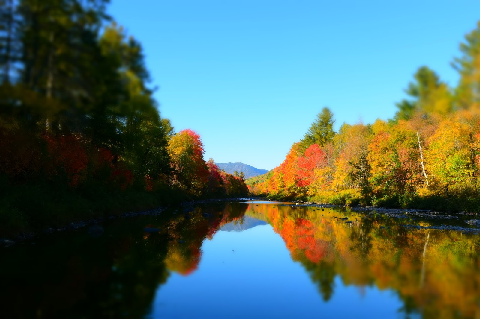
Maine, USA - October 1st 2016
 |
| A fishing village in Lubec, Maine |
Our visit to Maine wouldn't be completed if we didn't include the most famous Roosevelt Campobello International Park in our itinerary. This international park in New Brunswick Canada used to be the summer home of our 32nd president, Franklin D. Roosevelt ever since his childhood. It has turned into international national park in 1964, and the only park managing by both Canada and US. Lucky for us, the theme at the time was about First Lady Roosevelt, thus it befitting to have "Tea with Eleanor", where many of her political and personal stories of Eleanor Roosevelt were told between her favorite tea and tasty homemade cookies. We've learned that while their private lives were stranger than fiction, we still enchanted by the realism of the cottages, garden, and peaceful ocean view.
 |
| Second building where Tea With Eleanor was served |
 |
| Main building where president Franklin D. Roosevelt and family spent their summer vacation |
 |
| Roosevelt Campobello backyard with Maine in the distance |
From the eastern most point in Nova Scotia to eastern most point in Maine is actually going westward for our journey. For one, Maine is 282 miles westward of Nova Scotia. We made our ways to the famous lighthouse that has been on 1999 US stamp and countless magazines, the West Quoddy Head Light. Despite the "west" in the name, a granite marker confirms that we are at the easternmost point in the United State. Right underneath the 3,000lbs granite marker Fe is sitting on, a time capsule buried there and awaiting to be opened in 2058. Typically the time capsule contains rare memorabilia, artifacts, audio recordings, and many other valuable things from century ago. What's really down there is anybody's guess, or one can wait until half century later to know for sure!
 |
| West Quoddy Light House |
 |
| A time capsule was buried under the 3,000lbs marker (birds also flying south for the winter!) |
The Acadia National Park is less than three hours away, we jump in our Chase Turtle (our CT is like a turtle carry a house on its back) and gun it. Acadia is one of the oldest national park on east coast, and its mediocre parking at various attractions reflects accessibility design mentality of 1916; strange one-way system and utterly lack parking spaces even during low seasons causing tourists to either skip the attraction or forced to park illegally. Oh sure, one can take free bus, but that pretty much rule out the freedom to stay longer, having a picnic, or long hike at the scenic spot at your own leisure.
 |
| Rocky outcrops near Sand Beach |
 |
| Scenic turnout along Park Loop Road |
 |
| Another scenic turnout on Park Loop Road |
 |
| Rocky ledge along Park Loop Road provide excellence climbing opportunity |
Cadillac Mountain is about half the height of Mission Peak in Fremont, but at 1,529 feet, the "mountain" is much prettier with green lichen covered granite tops and panorama view of early autumn colors and dozen of small islands below. It is the tallest peak in the park and also the first mountain in US to receive the morning sun. Walking on the same path as President Obama and family traversed for their vacation here in July 2010, one can easily see why this scenic spot has been chosen for the occasion.


That night, we check out Bar Harbor village which wealthy folks have called home before to the massive fire destroyed everything in 1947. Since then, this coastal town rebuilt itself from the ashes and emerge as tourist attraction in middle of the Acadia National Park. While admiring the beautiful Bar Harbor night scene, we met Rob Macks the owner of Laughing Loon company that make high quality wooden sea kayaks. We quickly struck up a lively conversation with him. We found later that Rob made a beautiful custom Kayak used in the movie The Secret Life of Walter Mitty (2013). Rob explains the movie script depicts Walter gathers his courage by leap on to the kayak and paddle to the last known location of Sean, but during the filming, the story line was changed to show Walter character leaps onto helicopter just as it is taking off by a drunk pilot. Rob tracks down the kayak that he built for the movie and found it being used by one of the movie staff out in California! But tonight, he came to the dock to mentally prepares for a Chevy Acadia commercial shoot which scheduled for tomorrow morning. Bid him good luck with the commercial, we return to our motel after a long hard day.
 |
| A starless and moonless night at Bar Harbor |
 |
| Cruise ship docking further out in Bar Harbor |
Taking the weird one-way through Park Loop road, we got to Sand Beach and spent almost 35 minutes to find a parking spot, only to find the sand and the beach formation sub par to Monterrey or Carmel in California, but continue past the beach, one can see amazing rock cliffs jutting out to the blue ocean below. A short walk on smooth gravel path, the thundering sound of waves crashing can be heard on a deep rocky crevice called the Thunder Hole, especially at high tide. Just on the opposite side of the beach parking, there is Beehive trail that beckon to be explored. Steep climb through boulders strewn trail on Beehive trail for 30 minutes, we are beginning to realize the trail is scrambling up steep rock faces with huge drop off on one side. In many cases, one has to cling on iron staples on rock faces, tip toed on narrow ledge on exposed rocks, hugging rough rock faces and push one up on trembling legs, all with vertical rocks on one side and the steep 100ft drop off on the other side. We wanted to live another day, so we casually took the easy but longer hike which follow the small wooden planks as the trail continues around Bowl lake. Smooth surface of the lake reflects green conifers and maple yellow orange then the trail brought weary hikers up on top of the Beehive rock for a panoramic view of the Sand Beach and small lake farther down below. The hardcore Beehive trail also ends up here, so we don't really miss much of anything.
 |
| Sand Beach |
 |
| Sand Beach at night |
 |
| Thunder Hole |
 |
| Fe attempts the climb the hardcore Beehive trail |
 |
| Bowl Lake |
 |
| Bass Harbor Lighthouse |
Continuing on Park Loop road, we veer toward Jordan Pond. The scenic path take us around the pond in a well marked and non-technical trail. The afternoon sun casts golden ray across tranquil water to highlight red maple leaves overhang on top of the pond. From trail head, the Bubbles Mountain appears like two humps of a camel at a distance. The weather couldn't get any better and the pond view was so captivating that our 3.6 miles hike just breezing by. The pond water is clean and clear, in some cases, the national park recorded of up to 60 feet underwater visibility. This beautifully clean pond also serves as water supply for Seal Harbor village about 3 miles away.


In our quest for Bigelow Preserve in Stratton Maine, we drove across some of the most autumn scenic turnouts thus far on our trip, and also lucky enough meet the Appalachian trail section-hikers near Wyman Township. Struck up a conversation with "I-wander" and "Chicago", the exuberance young man and his lovely companion were doing content inventory of their backpacks before their last hike of the season. They have already been on the Appalachian trail for 6.5 months, and their disheveled appearance told of the rough hiking tales. When asked what is the most important things for them to carry on the hike, "Anything that you carrying that has not been touch in few days should be tossed" came the reply. Roll up a small cigarette between his callous fingers, I-wander continues "there is a short list (a very short list) that one must have in procession to survive out here. Everything else is just dead weight", and he puffs out a smoke circle. We guiltily glimpse at our trusty Chase Turtle with all sort of electronics, fridge, AC inverter, rooftop tent, luggage, gas stove, folding chair, air pump, battery booster, secondary battery, 5gal water tank, etc. we bid them good luck and continue on our way.
 |
| Sugar Loaf Ski Resort near Bigelow |
 |
| Old dam near Bigelow |
 |
| Autumn color is peaking near Bigelow |
 |
| Scenic turnouts along highway 27 near Bigelow |
 |
| Quill Hill overlook near Bigelow |
Follow our itinerary, we arrived at Mount Blue State Park just in time to catch beautiful sunset on Mount Blue framed the beautiful Webb Lake. The serenity swept over us as we gaze across to last sun ray painted the top of the blueish mountain red from a distance. As the sun ray disappearing, the temperature drop considerably. We return to our Chase Turtle to find that all the drivings on dirt roads and deep potholes of Maine have taken it tolls on Turtle front tires; deep cuts all the way to casing on already worn threads, bottom engine cover hanging off its retainers, etc. Well, its time to give our Chase Turtle the TLC it needs!


We setup camp for the night and head to Portland Maine for Chase Turtle repair the following morning.Taking advantage of some down times, we explore some of the freshest seafood in Old Orchard Beach area. The Scarborough Fish and Lobster shack few miles down the road, doesn't seem much from the outside, but the quality of the lobsters here really come down to exact cooking duration, boiling recipe, and lobster type. This lobster shack has that secret recipe; from the juicy, slightly salty, and plump claw meat, to the smooth and buttery head roe tomalley, to the tender and sweet tail meat. The whole tasty lobster still warm when deliver right to our table by the most unassuming, casual and friendliest guy, John. We actually had two small soft shell female lobsters the day before from this shack, but to be sure of their quality, we dropped by the next day for larger hard shell female lobster and still receive the same great tasting lobster along with courteous greeting and welcoming demeanor from the proprietor. Now driving 3,000 miles back to California and our mouths still salivating from the mere thoughts of Scarborough Fish & Lobster amazing lobsters.
GPS Coordinates:
Roosevelt Campobello International Park - 44°52'36.0"N 66°57'27.9"W
West Quoddy Head Light - 44°48'54.5"N 66°57'02.3"W
Acadia National Park - 44°24'32.3"N 68°14'50.2"W
Cadillac Mountain - 44°21'09.4"N 68°13'30.4"W
Bar Harbor - 44°23'28.8"N 68°12'15.4"W
Sand Beach & Beehive Trail Head - 44°19'53.6"N 68°11'07.0"W
Mount Blue State Park - 44°40'49.8"N 70°26'51.5"W
Scarborough Fish and Lobster - 43°33'52.8"N 70°23'44.4"W
Previous Post:
Prince Edward Island, Canada - September 24th
References:
- Destination details were extracted from respective attraction, hand-out literature/brochure, or website, and Wikipedia
- Coordinates are from Goggle map in Degrees, minutes, and seconds (DMS)